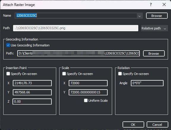
As simple as ATTACH. BricsCAD v25 Pro will detect a world file and populate the Attach Raster Image dialog with Insertion Point coordinates (X,Y, not Z), Scale X and Y, and Rotation Angle.
Insert (tab)>References (panel)>Attach. The Select Reference file dialog opens. Browse and select an image file. The Attach Raster Image dialog opens. As shown below the Insertion Point, Scale, and Rotation settings are populated automatically from the world file. Choose OK and the image is inserted in the drawing at the correct position specified by the world file.

Recent Comments